In 2019 I did an internship at Deltares, a knowledge institute in the Netherlands for water and subsurface research. I used remote sensing, specifically Sentinel and Landsat data accessed through Google Earth Engine, for tracing the changes in morphology of shoals and channels in the Dutch Wadden Sea. I introduced two automated methods for delineating channels in the tidal system at the scale of years and months, using optical/NIR (Sentinel-2 & Landsat) and radar (Sentinel-1) imagery. This culminated into a 33 page report, which can be downloaded below:
Abstract
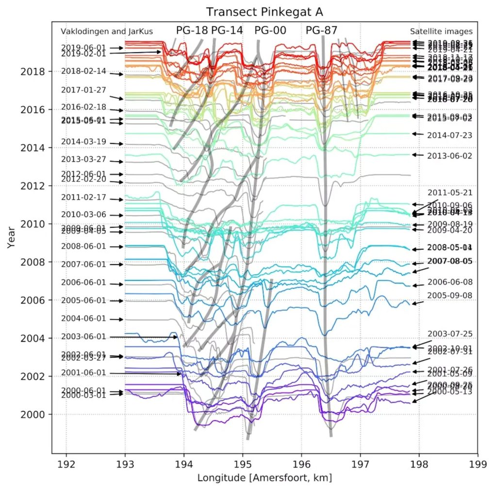
The Wadden Sea is a dynamic region undergoing rapid change due to natural morphodynamic processes. Monitoring these changes and extracting conceptual models is limited by the frequency of bathymetric studies (once every ∼6 years in the Netherlands). We therefore present several new techniques for studying these changes using high cadence (every ∼8 days to 2 months) and high resolution (10 – 30 m) optical and radar satellite imagery. The Frisian Inlet is used as a case study for these techniques. This region has both sub- to intertidal (channels, sandbars and shoals) and supratidal morphological features (islets and islands) which have been studied extensively in the past. The existing conceptual models for these features comprising inlet channel migration cycles and shoal growth pat- terns are based mainly on the existing low cadence bathymetry. They are assessed using the new techniques, resulting in both a test of existing morphodynamical theories and serving as a prime example for the application of the novel remote sensing techniques. These techniques can be applied in other parts of the Wadden Sea and in tidal flats around the globe. We also present an outlook to further possible developments of remote sensing techniques in this field.