Tracing the evolution of the Frisian Inlet using optical and radar satellite imagery
In 2019 I did an internship at Deltares, a knowledge institute in the Netherlands for water and subsurface research. I used remote sensing, specifically Sentinel …
In 2019 I did an internship at Deltares, a knowledge institute in the Netherlands for water and subsurface research. I used remote sensing, specifically Sentinel …
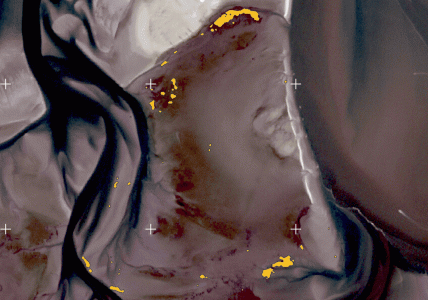
Written by Jelle Mes Abstract In 2024 a large increase in young mussels (Mytilus edulis) was observed in the Dutch Wadden Sea. Mapping these reefs …
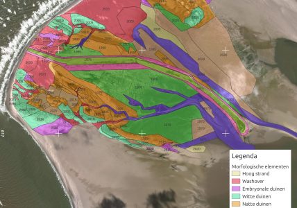
In mijn vorige blog post (zie link hieronder) heb ik laten zien hoe de evolutie van Rottumerplaat van 1964 tot 2024 met behulp van satellietbeelden …
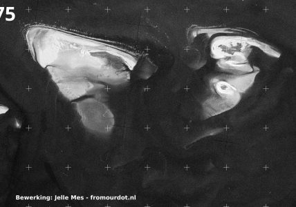
In april 2023 heb ik 10 dagen op Rottumerplaat gezeten als vogelwachter, waar bij ik René Vos, die een groot deel van het zomerseizoen daar …
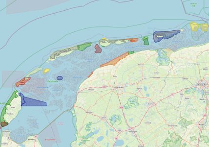
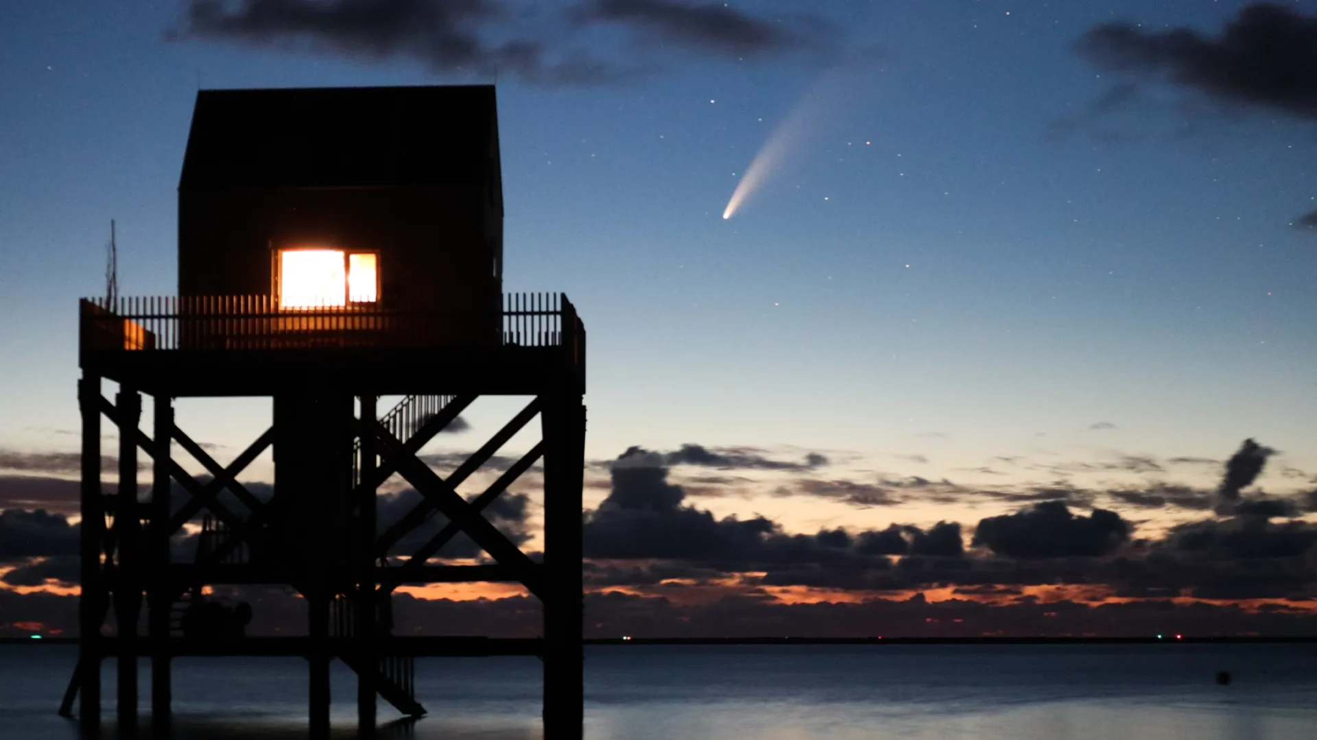
See full screen De Waddenzee strekt zich van Den Helder in Nederland tot Esbjerg in Denemarken. Dit enorme gebied valt onder UNESCO World Heritage en …
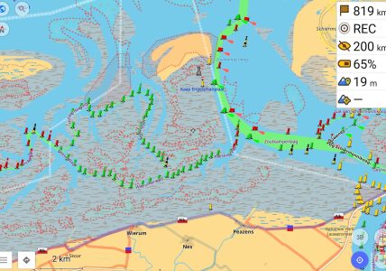
OsmAnd+ is a mobile web app with many features. I have written before about how to set it up for wintersports and navigation at sea …
OpenStreetMap does not just contain data about streets, but it also has nautical data, “seamarks”. OpenSeaMap is one visualization of that data. My personal favorite …
OsmAnd+ is the full version of OsmAnd: the former is a paid app on the Google Play Store, the latter is free but is limited …
It’s the time of the year for fun in the snow! Many people in the Netherlands go on wintersport vacation and though it might be …
A fun project with @babeburnz (Instagram) to try to capture their fire tricks using the slow motion options of a GoPro.